Day 1 - 10.2
miles
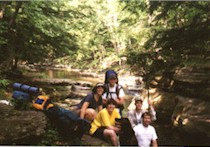
Started from the trailhead at 1:50pm.
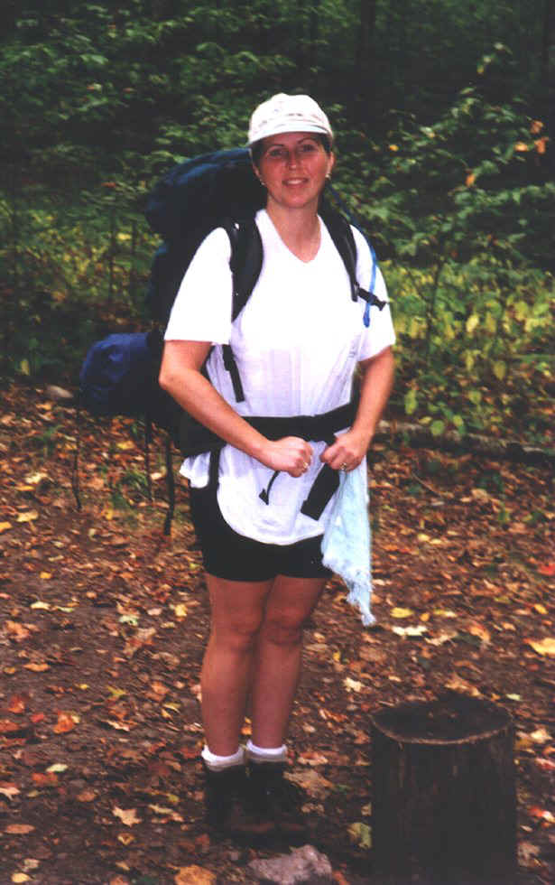
This was the first time I had my new pack on fully loaded and actually
planning on hiking with it. As a matter of fact, this was my first
backpacking trip and first experience with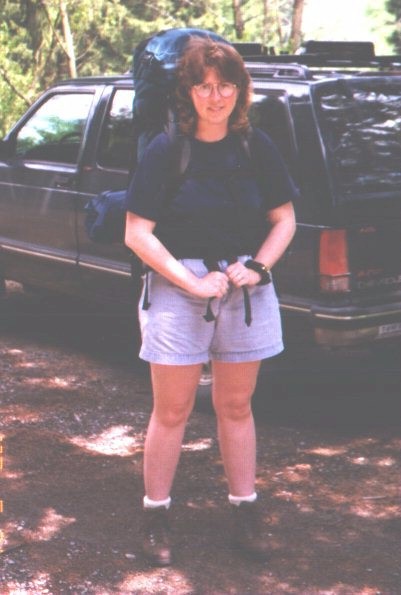 wearing a full backpack.
Going up the first climb I was very apprehensive...in my mind I was saying, how can I do
this. But after making a few minor adjustments as I walked, the pack gradually
became one with me. It felt right and I became very confident wearing it. I
was just so excited to get my first trip under way.
Our first mile we were a little confused. We knew we were on the
right trail but the map and description mentioned several things that we didn't
notice...one being a trail register and a fallback campsite that was no where to be found.
After a few minutes we decided to keep hiking and look for the next
landmark...you really can't get lost following the orange blazed trail.
 The first
mile was a challenging hill climb (at least for me). We crossed several small streams.
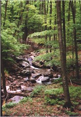
About 4 miles in we came across an area called Rock Run...accurately named. This
area is beautiful. The first
mile was a challenging hill climb (at least for me). We crossed several small streams.
About 4 miles in we came across an area called Rock Run...accurately named. This
area is beautiful.
We saw 2 deer on this section of the trail. There wasn't a problem filling water bottles
as streams and mountain springs were very abundant. Around the 8th mile in we came across
a challenging hike crisscrossing a pipeline swath. I had a struggle doing the up-hills in this section. Still finding my hiking legs.
We had brief showers off and on during the day but with the heavy forest
foliage we hardly felt a drop. We reached our campsite at 10.2 miles @ 7:25pm. 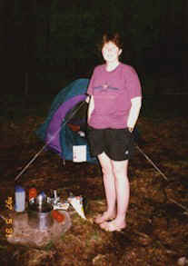
It calls
for 6 hours to reach camp so we shaved off a 1/2 hour...not sure how we did that!
We
stopped a few times on the up-hills to refuel with water and power bars/power gel (not bad
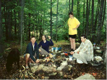
stuff). The campsite was beautiful right along a natural spring.
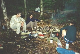
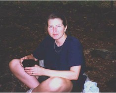
Once there,
we scurried to pitch the tent for fear of heavier rain. I filled water bottles while Dave got the Whisperlite going for our meal. Then it
was into a clean shirt - what a wonderful feeling! It's the little things in life
:^) Just as we cleaned up from our meal the rain started and we had a downpour
all night.
Day 2 - 10.4 miles
After a light breakfast and refilling
the water bottles, we broke camp and headed out about 11:10am (late start - no meetings to
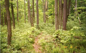
attend). The trail criss-crossed up the mountain onto an old logging path
and onto an old
 railroad
bed several times.
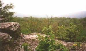
There was a steep climb up Sullivan Mountain where there was an extensive
view of the Allegheny Plateau...well I'm sure it was breathtaking. railroad
bed several times.
There was a steep climb up Sullivan Mountain where there was an extensive
view of the Allegheny Plateau...well I'm sure it was breathtaking.
Due to off and on showers throughout the day it was very overcast and we were unable to
see the view. I took some photos anyhow. It was a good opportunity for a rest.
Around mile 16 the trail switchbacked down the mountain. Saw 2 snakes on
the trail...they moved so quickly I was unable to get a good look at them...so I moved
quickly too :^) Due to the overnight rains, the majority of the trail was mud, mud, and
more mud.
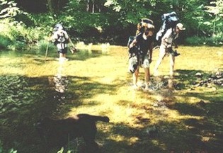
We reached Pleasant Stream @ mile 18...here it was every man/woman for
themselves. It was a c-o-l-d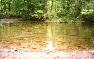 stream crossing without a bridge. Wouldn't you know I would
pick the deepest part of the stream to cross.
The difficult part was crossing on all the small stones and trying to keep your balance.
The further I walked the deeper it got until it was up to my =8^0 yep, and it was cold!!! stream crossing without a bridge. Wouldn't you know I would
pick the deepest part of the stream to cross.
The difficult part was crossing on all the small stones and trying to keep your balance.
The further I walked the deeper it got until it was up to my =8^0 yep, and it was cold!!!
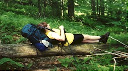
After we both made it to shore we decided we'd cook a little lunch since
we had all day to get to the next campsite. There was a light rain but as warm as we were,
it felt good. We plopped the packs under the trees and sat on the stream's shore to eat
lunch and to tend to some pretty nice blisters.
After regrouping we climbed the mountain to another vista which, again, there was poor
visibility...took photos anyhow. Now it's downhill to the next campsite at Wallis Run.
Several nice areas to choose from along the stream. We made it to the camp site @
6:35pm and pitched the tent again in a hurry for fear of heavier rains than we were having
all throughout the day. It was to take 6 hours to do this 10.4 miles of the trail but we
added an hour when we stopped at the stream to cook a meal and regroup ourselves.
Again, same as the night before, I refilled the water bottles while Dave got the meal
started. And ahhhhh, yesssss...my nice clean shirt! The heavy rain started @ 8pm and never
did stop!
Day 3 - 7.2 miles
Due to the heavy rain we had to cook
our breakfast in the vestibule. It was going to be a very muddy day! After breaking camp
and donning raingear we headed out @ 10:20am. What I found amazing all throughout the trip
 was a very low bug population which made the trip that more pleasant. It's early in the
season for those little critters yet. Anyhow, we climbed up a steep grade to Sprout Point
Vista...again, poor visibility with the heavy rains. was a very low bug population which made the trip that more pleasant. It's early in the
season for those little critters yet. Anyhow, we climbed up a steep grade to Sprout Point
Vista...again, poor visibility with the heavy rains.
The trail headed slightly downhill onto an
old logging trail crossing several small streams. Because of all the rain, the trail
was a mud march.
We walked along Burnetts Ridge for @ 2 miles before heading onto an old railroad grade for
several miles which eventually took us back to our vehicle at 1:35pm.
On the drive out we saw 3 more deer and also passed a man and woman just
starting their 2nd mile crossing one of the logging roads. They had traveled 4 hours from Lancaster to do the trail.
Unfortunately, they won't see dry weather during their trip.
This was also the woman's
first backpacking trip. I told her it was mine too and we wished them well. They seemed in
good spirits despite the weather.
I picked up some knowledge on reading maps. I'm no good if someone tells me how to do it,
I need to grasp bits and pieces and learn by applying it. The rain really didn't bother
me, we had fairly mild temps throughout. I'm glad I got to experience different
conditions on the trail. Despite a few blisters and some aches and pains...I'm ready
to head back out! This was truly a challenging, and rewarding experience for me.
I'll always remember this, my first trip! |
 way in '97. It only
took us 2.25 hours to hike in to the campsite that we camped at last year on our 2nd night
(at 7.2 miles).
way in '97. It only
took us 2.25 hours to hike in to the campsite that we camped at last year on our 2nd night
(at 7.2 miles).
 Along
this stretch we passed a group of 3 guys and then 1 other man doing it solo.
We then hiked steeply up Sullivan Mountain and descended on the other side
along Ellenton Ridge.
Along
this stretch we passed a group of 3 guys and then 1 other man doing it solo.
We then hiked steeply up Sullivan Mountain and descended on the other side
along Ellenton Ridge.